
Marches Way

![]()
Marches Way
This walk is 200 miles long. Starting from Chester it follows the borders betwen England and Wales to Cardiff. The section of the walk described here is (almost) all in Cheshire and is 27 miles long. The Cheshire section of the way goes from Chester to Whitchurch.
The OS landranger map 117 (Chester and Wrexham) covers the walk but the walk is not marked. OS Explorer map 257 (Crewe and Nantwich) covers all but the top 5 or 6 miles. At the time of writing the explorer map for Chester is not yet available - this will havbe the rest of the walk in it. A description of the full length walk (Chester to Cardiff) is available in the book "The Marches Way" by Les Lumsdon and published by Sigma Leisure.
I did this walk on the 22nd/23rd of February 2000. The weather was dry with a little pale sunshine. However, heavy rain before I went on the walk meant that there was lots of mud around. Some fields were boggy with no easy diversions available.
This was my first time taking the OS explorer 1/25000 scale maps. These have the field boundaries marked which makes it extremely difficult to get lost. The Marches Way is clearly shown with green diamonds indicating the route. Nevertheless, I did manage to wander slightly off course on two occasions, once soon after the start in Whitchurch and once about 2 miles before Malpas. Both times I followed a right of way straight on when I should have turned to follow the Marches Way. I easily found my position with the explorer map both times.
The Marches Way is usually marked with a White arow labelled "Marches Way". However, the arrows are sporadic and some sharp turns are not marked at all (see above!). I think I was lucky to decide to but the bigger scale map before this walk.
I stopped in Farndon at the Farndon Arms. This is easy to find since the Marches Way goes right past its door! £30 a night for bed and breakfast and very reasonable prices for the evening meal as well as a bar with a selection of beers. Highly recommended though you'd be wise to book since they only have 7 rooms and were fully booked for 2 nights in the week I was there. Phone 01829 270570.
Views on the Way
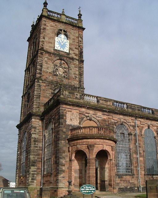 |
Whitchurch Parish Church Walking north from Whitchurch train station gets you to the large Parish Church. You turn West here and keep going until you reach the Shropshire Union Canal about a mile and a half later. |
 |
Danson's Bridge over the Shropshire Union Canal This is the bridge where you meet the Canal. Unless of course you've already managed to follow the wrong footpath when descending the hill from Whitchurch in which case this bridge is where you rejoin the path you were meant to be on all along. Anyway we now follow the canal for about two and a half miles. |
 |
Grindley Brook Locks Half way along the canal you come to this flight of three locks at Grindley Brook. Another couple of locks come shortly afterwards. The Sandstone Trail starts here and you follow this for a few miles. |
 |
Willeymoor Lock This is the last lock you'll see for the rest of the walk. It's also the first Marches Way arrow you'll see. The Sandstone Trail and Marches way are still following each other here so we turn north, away from the canal. |
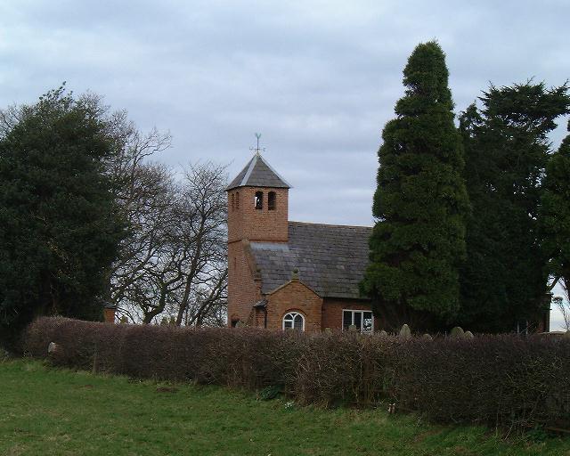 |
Old St Chads Another mile sees you finish the steepest climb of the walk to Old St Chads. This used to be on a main road but times, and road locations, have changed, leaving Old St Chads in a pretty location in a field on the top of a hill. One more field and the Sandstone Trail goes north while we continue West towards St Chads. |
 |
St Chads Larger and more elaborate than its Old namesake St Chads is a useful landmark but unfortunately marks a return to a small stretch of road walking. As you rejoin grassed paths you will get distant views towards the Peckforton Hills to the North. Continuing West we pass my second unintentional diversion from the route as well as some boggy fields. |
 |
Malpas Malpas is 8 miles into the walk which is half way through todays distance. There are more boggy fields between here and the village though. |
 |
Malpas Parish Church Malpas is rather picturesque. You turn left at the village cross and then right again at this parish Church. We can see that its taken 3 hours to come 8 miles. On such easy, flat terrain this is poor progress. I blame the mud. On leaving Malpas you get views over the Dee valley to the Welsh hills. We head North West through Shocklach before turning North, parallel to but still out of sight of, the Dee. |
 |
River Dee Finally, we turn West and get our first glimpse of the Dee. Doesn't look much to keep the Welsh in check does it? Strangely, the paths alongside the Dee, which is notorious for flooding the fields beside it, are some of the least muddy of the whole walk. |
 |
Farndon Bridge So, with 16 miles walked you come to Farndon Bridge. An attractive landmark for the end of the day's walking and the end of our walk along the Dee ... at least for a few miles. |
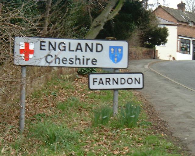 |
Entering Farndon Don't worry. You didn't actually leave England, its just that the sign wouldn't fit in the middle of the bridge. |
 |
Farndon Arms 16 miles walked and time for tea. From Farndon we head North to Churton and Aldford away from the Dee for a while. On leaving Farndon you get a good view over the Peckforton hills to the right. The dramatic edge of the hill on which Beeston Castle is built is very clear. There are about 11 miles to do on this stage of the walk. |
 |
House In Aldford We've been through some pretty villages on this walk but Aldford must rank with the all-time model villages. This house isn't exceptional - they all look like this. |
 |
Aldford Church The church carries on the same building style as the houses. You go past the left hand side of the church where, as at Malpas, there is the remains of a motte and bailey castle. |
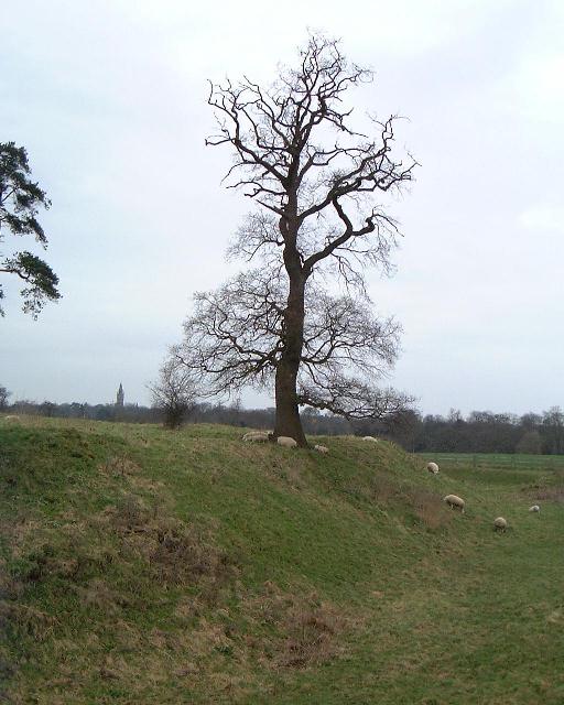 |
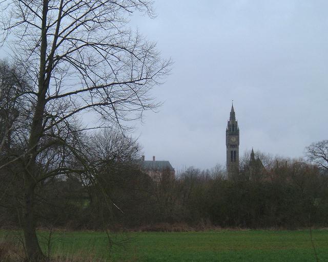
Aldford Castle Deep ditches tell of a large castle here once upon a time. But even the sheep can storm it now. In the distance you can see the 'Big Ben' style clock tower in Eaton Hall. |
 |
Iron Bridge This is a garden ornament for Eaton Hall and marks the half way point for todays part o the walk. We cross the bridge and rejoin the river Dee heading north past Eaton Hall. We leave the explorer map here but the directions are easy - follow the river until you get to Chester! |
 |
Eaton Hall The Big Ben replica is now clearly visible. The clock even chimes like Big Ben. Various attractive buildings are also seen on this stage of the walk but we never get any closer to the hall itself. This section of the walk follows the rather overgrown bank of the Dee. At one point a large tree had fallen across the path and a diversion was needed. Eventually the land opens up until you pass meadows all the way into Chester. |
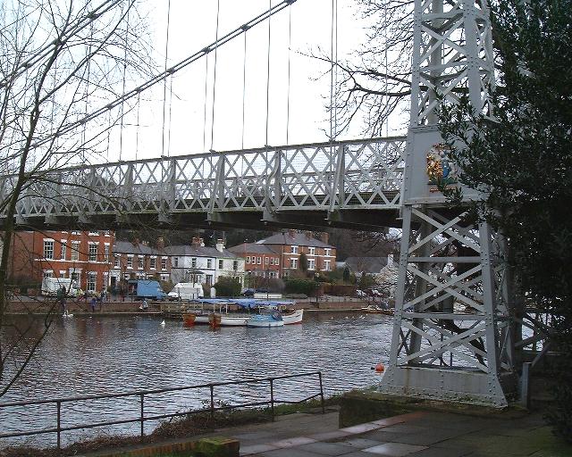 |
Iron Suspension Bridge As buildings close in on both sides of you this is the first bridge you will see. Don't cross here though, keep by the river past an old water wheel to the next bridge. |
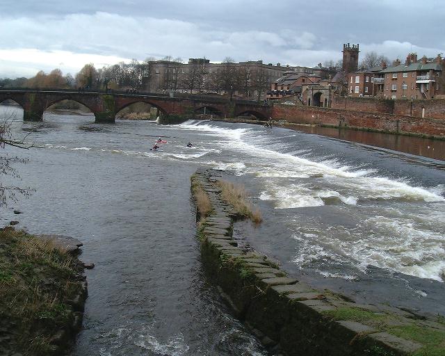 |
Weir In Chester This weir dates back to the 11th century and was built to allow milling along the river. You cross the bridge ahead, heading north through the busy shopping streets before circling left down onto the banks of the Shropshire Union Canal. |
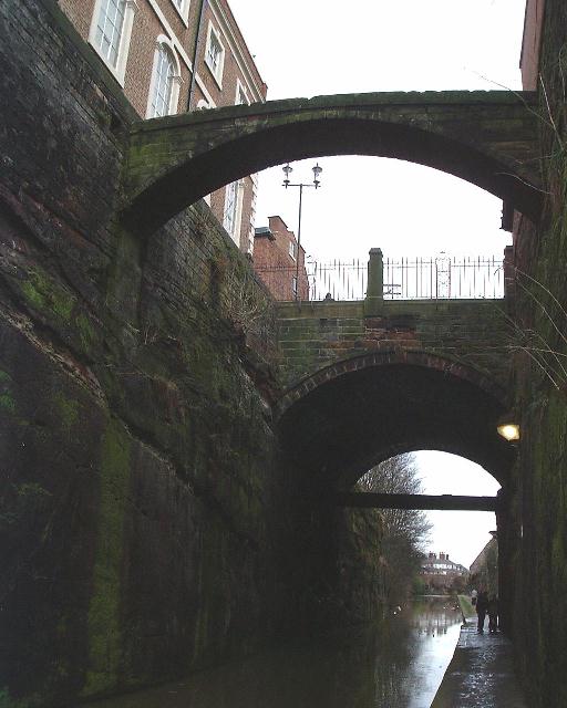 |
Bridges Over the Shropshire Union Canal The canal cuts right through some rocky outcrops in Chester. The first of these bridges connects a prison to its chapel - Chester's version of the Bridge of Sighs. The second carries Northgate across the canal. Continue along the canal under three more bridges before crossing a bridge next to the steam mill. Continue straight ahead to the train station. 11 miles today, 27 miles all told. |
This document
maintained by rb-jarvis@woodhouseclose.free-online.co.uk.
Material Copyright © 2000 Richard Jarvis