
Walking

![]()
Walking
The only sport I do on a regular basis is walking. Mostly around Cheshire with excursions further into the peak district. You can get a feel for the area by visiting the peak district walking site.
Long Walks in Cheshire
Cheshire has some footpaths between 20 and 40 miles long. The ones I have walked are shown on the map below. Click the trail names for more details.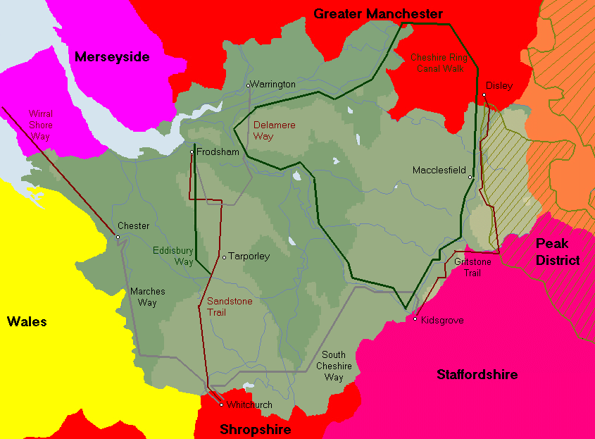
Cheshire Walking Books
I have used a number of books to inspire my walks. Here are ones I've finished so far:
 |
Carl Rogers Circular Walks along
the Gritstone Trail and Mow Cop Trail Takes in the entire Gritstone / Mow Cop Trail in 12 circular walks of 4-7.25 miles long. It is fairly easy to do pairs of walks if you are looking for something a little longer. Useful for people who want time to acclimatise to the climbing needed when compared to the Sandstone Trail. These walks have some of the best views in Cheshire and are well worth completing. |
 |
Ruth Rogers Circular Walks along
the Sandstone Trail Takes in the entire Sandstone Trail in 12 circular walks of 4 - 7.5 miles. Also allows the trail to be walked from North to South in one easy go, although the trail is so well waymarked it it doubtful that the guide is really needed. The walks are well described with sketch maps and would make an easy way to approach the trail for those who don't fancy walking the entire length in one go. |
 |
James F Edwards Cheshire: Walks
for Motorists 30 walks between 2 and 7 miles (though typically between 4 and 6 miles). 13 of the walks are clustered on, or around, the Sandstone Trail. Another 13 are in the North East of the county. None of the walks are strenuous and all are circular walks with clear parking instructions. A good book for those who haven't done much walking. |
 |
Jen Darling West Cheshire Walks 40 walks between 2 and 8 miles. Around half the walks are clustered close to Warrington. The other half are spread as far South as the A534. Since this region is not particularly hilly, the walks are not especially strenuous. This book is useful for finding worthwhile walks close to Warrington. |
 |
Tony Bowerman Walks in mysterious
Cheshire 15 short walks (1.5 - 4.5 miles). Poor value if you are looking for a book of walks, but good value if you like to know the local history and ghost populations as you walk. A good selection of locations too. |
And here are a few I have yet to finish:
 |
Carl Rogers Walking in Cheshire |
| Guide to the Transpennine trailbetween Southport and Hull. Passing through parts of Warrington too. | |
 |
Cheshire Ring Canal Companion The third (and final) guide to the Cheshire ring. This one is aimed at boaters but usefully provides details of distances between bridges and locations of pubs. |
| Cheshire County Council Cheshire Ring
Canal Walk Published in 11 sections and covering the entire 97 mile walk with explanations of sites of interest. |
|
 |
John N Merrill Walking the Cheshire
Ring Less background information than the above series. But rather thinner. Details of some places to find accomodation along the way. |
 |
Jen Darling Walks In North Cheshire Walks around Warrington. Rather less inspiring than walking in the hills but these might be pleasant enough for a few hours. |
 |
John N Merrill Long Circular Walks in
Cheshire 12 walks varying from 10 to 16 miles in length. |
 |
Carl Rogers Wirral Shore Way Links Chester to Hoylake following the old path of the River Dee. About 24 miles long so potentially a days walk. Or easy 2 days. |
Useful Links
Your taxes have funded some additional temporary footpaths. Visit the countrywalker web-site to get lists of these paths, complete with maps, county by county.
These are sites about Cheshire and the Peak District:
Cheshire: http://website.lineone.net/~nwra/nmcheshire.htm
Cheshire Walks:http://www.losgreen.freeserve.co.uk/
Cheshire Web Ring: http://www.mikecorlett.com/cheshire.shtml
Cheshire Ring: http://www.richardhill.co.uk/cheshire.htm
More Cheshire Ring Part 1: http://pages.prodigy.net/brinnand/ramblings/cruise3a.htm
More Cheshire Ring Part 2: http://pages.prodigy.net/brinnand/ramblings/cruise3b.htm
Chesire: http://www.britweb.com/n-england/cheshire/
Birchwood: http://www.warrington.gov.uk/csv/parks/Birchwood/BirchwoodHome.htm
Peak District Walking: http://members.aol.com/pdwalks/
Peak-Net:http://www.peak-net.co.uk/
Other Paths in Cheshire
I'ne not had a chance to fit these onto the main map yet but here are some of the paths I'm looking at for future inclusion:- Baker Way - 12 miles linking Christleton (near Chester) to Delamere Forest Park (where it meets the Eddisbury Way). Recently extended, the route now starts and ends at railway stations.
- Bishop Bennet Way - Contorted route that seems to start at Willeymoor lock and wind its way towards Beeston Castle. Who was Bishop Bennet anyway? Some research needed here I think.
- Bollin Valley Way - 30 miles joining Macclesfield Riverside Park to the Manchester Ship Canal at Dunham (near Partington?) passing through Prestbury, Wilmslow and Styal along the River Bollin
- Bridgewater Canal - Runcorn - Warrington - Lymm, Altrincham, Sale and Stretford
- Cestrian Link Walk- unmarked route invented by John Davenport to link the Pennine Way with Offa's Dyke Path. Crosses Cheshire from east to west.
- Crewe and Natwich Circular Walk - a circle around Crewe and Nantwich (but you'd already guessed that) around 28 miles long
- Dane Valley Way - along the River Dane, starts just NW of Middlewich where it follows the Cheshire Ring for about a mile before turning East along the Dane. Finishes in Buxton after passing the source of the Dane at Dane Head. Marked with DVW on the yellow markers.
- Longster Trail - 9 miles Pipers Ash (Chester) to Helsby Hill
- Macclesfield Canal - Church Lawton - Congleton, Macclesfield, Bollington, Poynton
- Mersey Way - 19 miles Hale (Widnes) to Rixton (Warrington)
- Middlewood Way - 11 miles Marple to Macclesfield
- Millenium Heritage Trail - follows Weaver from Frodsham and crosses the Eddisbury Way in a couple of places. Not sure where it finishes up.
- Newton Way (nr Kingsley)
- River Dee Lots of paths follow the river - especially between Chester and Farndon which is a picturesque section of the Marches Way
- Runcorn History Trail 6 miles including Manchester Ship Canal and Norton Priory
- Salters' Way - Created by John Merrill to follow an ancient salt road. 25 miles from Northwich to Saltersford Hall.
- Shropshire Union Canal - Ellesmere Port, Chester, Natwich, Audlem + Llangollen Branch + Middlewich Branch
- Trans Pennine Trail - actually goes from Southport to Hull but the 'Cheshire' section is from Hale to Sale. It may follow the Mersey Way but I'm not sure
- Trent and Mersey Canal - Runcorn - Northwich - Middlewich - Sandbach - Alsager
- Vale Royal Round - 34 mile walk linking part of the Sandstone Trail with the Whitegate Way, the Weaver Parkway, the Trent and Mersey Canal and the river Weaver.
- Weaver Valley Way - 20 miles Winsford to Frodsham allong the River Weaver, although the walk is still incomplete. Sections presently available are Winsford - Hunts Lock in Northwich (5.5 miles) and Saltersford Locks - Sutton Weaver Bridge (8 miles)
- Whitegate Way - 6 mile long former salt carrying railway from Winsford to Cuddington
- Wirral Way - 12 mile long disused railway from Hooton to West Kirby
- Wirral Shore Way - 21 mile long from Chester to Hoylake
Walking Hazards
Its a hard life walking ...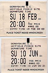 |
Not so humorous, or life threatening (to me at any rate) as the others but rather sadder. The two car park tickets for Hayfield car park (near Kinder Scout) are my last walk before foot-and-mouth disease restrictions and the first one after Derbyshire was declared 'open'. There were still some restrictions in effect and disinfectant backets were in place on the climb up to Famine Hill. |
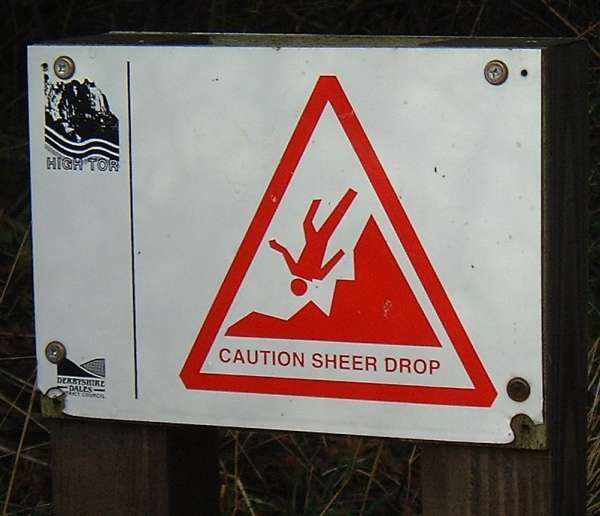 |
I think the sign says it all really ... On the approach to High Tor overlooking Matlock Bath. |
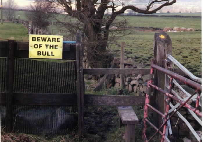 |
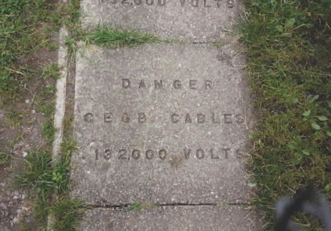
No, I didn't see it. Heading towards Bollinhurst reservoir and Lyme Cage folly. |
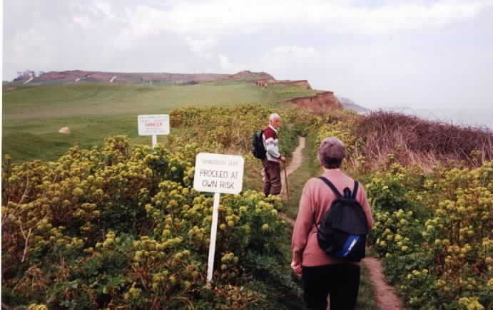 |
I'm not sure they even read the sign. Anyway, the cliff can't be dangerous - it's already fallen into the sea. This is near Cromer on the Norfolk coast. |
 |
Possibly the most careless nursery in the world? Near Wilmslow. |
 |
A whole path was made up of these along a canal. Some of them were loose. |
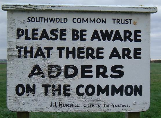 |
Failing to drop me over the cliff at Cromer hasn't dampened my grandparents spirits. Oh no! Now they want to feed me to the snakes. |
Walking Photos
3 July 2001. Baker Way.
2 July 2001. Longster Trail.
10 June 2001. Kinder Downfall my first hilly walk following foot and mouth disease.
This document maintained by rb-jarvis@woodhouseclose.free-online.co.uk.
Material Copyright © 1999,2000 Richard Jarvis